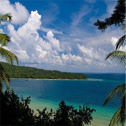
About Andaman & Nicobar Islands

Andaman & Nicobar Islands is a Union territory, with Port Blair as its capital. The Islands - a total of 572 in number - are located in South-East of the Bay of Bengal, between 6˚ and 14˚ North latitudes and 92˚ & 94˚ East longitudes. Of the total, only 36 are permanently inhabitated and these are separated from each other by vast sea.
For administrative purposes, the Islands in the Union Territory are grouped into three districts viz. North & Middle Andaman, South Andaman, and Nicobar. While the North & Middle Andaman group of Islands stretches over 120 Km. in length with a width of 51 Km., the South Andaman are around 130 Km. long and the Nicobar group - also known as southern group - stretches over 236 Km.
The total geographical area of the Islands is 8,249 Sq.Km. district-wise distribution along with revenue area and forest area are shown in Table below
Geographical Area
| Description | Area (Sq.Km.) |
|---|---|
| Total Geographical Area | 8249 |
| North & Middle Andaman District | 3106 |
| South Andaman District | 1841 |
| Nicobar District | 3302 |
| Revenue Area | 659.92 |
| Urban | 16.64 |
| Rural | 643.28 |
| Forest Area | 7589.08 |
As per the 2011 Census, the rural population in Andaman & Nicobar Islands is 2, 37,093 and urban population is 1,43,488 The percentage of urban population to total population in the Islands at 39.49% is, however, above the national average of 31.2 %.
Education:
There are 45 pre-primary schools, 228 primary schools, 76 middle schools, 52 secondary schools, and 57 senior secondary schools in the Islands. The district-wise status is as shown hereunder:
Health Scenario:
The health services in the territory of A & N Islands started during the British colonial period and was restricted only to the Britishers and sick convicts. Initially there were only three hospitals at Bambooflat, Ross Island and Haddo. The health care services in true spirit were extended to other parts of the Islands only after independence.
The main objective being promotion of good health by curative, preventive, promotive and rehabilitative health care services with more attention to grass root level enabling the participation of community to ensure a long and healthy life. Protection of all children and through vaccination, encourage people to adopt small family norm and save the territory from over population, reduction of birth, death and infant mortality rates and keep these indices stable.
Health Indicators :
The total fertility rate of the Island at 2.1 is comparable with All India figures. Comparative figures for infant mortality and maternal mortality rates and other indicators are provided in Table below.
| S.No | Items | A&N Islands | India |
|---|---|---|---|
| 1 | Total population (census 2011) (in million) | 0.38 | 1028.61 |
| 2 | Decadal Growth (Census 2011) (%) | 6.86 | 21.54 |
| 3 | Crude Birth Rate (SRS 2011) | 14.29 | 21.8 |
| 4 | Crude Death Rate (SRS (2011) | 5.72 | 7.1 |
| 5 | Total Fertility Rate (NFHS III) | 2.1 | 2.7 |
| 6 | Infant Mortality Rate (SRS 2011) | 24.96 | 44 |
| 7 | Maternal Mortality Ratio | 91.98 | 301 |
| 8 | Sex Ratio (Census 2011) | 878 | 933 |
| 9 | Population below Poverty Line (5) | 1.57 | 26.1 |
| 10 | Schedule Cast Population (in millions) | 0 | 166.64 |
| 11 | Schedule Tribe Population (in millions) | 0.03 | 84.33 |
| 12 | Female Literacy Rate (Census 2011) (%) | 71.08 | 53.7 |
Health Infrastructure:
A & N Islands are situated about 1200 Km. from the mainland. Keeping in view the isolation of the Islands - particularly in habitated ones, difficult terrain and communication constraints, all the PHCs in the Islands are provided with 10 bed ward and CHCs with 40-70 beds, a laboratory, labour room, injection room, dressing room, X-ray machine, and blood transfusion facilities in conformity with the IPH standards. Further, these have captive power generators, ambulances, refrigerators and deep freezers to maintain the cold chain.
